

Photo mapping Uganda’s New Cities - Facebook Community Impact Micro-grant
OpenStreetMap Uganda in partnership with YouthMappers led a photo mapping project that was designed to enhance the quality and add more detail to the remotely contributed data from Mapping New Cities Project. In early June 2021, OpenStreetMap Uganda trained a team of Youth Mappers from the Geo YouthMappers, Team Good Mappers, Mappers for Life, and Vision Mappers on how to...

How OpenStreetMap changed my worldview
Five years ago, Morish Awania took up a new role as a security guard in Kampala, Uganda after missing out on an opportunity to complete his high school education due to financial constraints. Then, Morish joined the Humanitarian OpenStreetMap Team (HOT Uganda)* as a security guard two years ago where he developed an interest in OSM as he watched his colleagues taking part in mapping activities. This marked the beginning of a new and uncharted career path for Morish...

Supporting Noble Farms Uganda Ltd in Gulu
OpenStreetMap Uganda in collaboration with OpenGIS Uganda is working with Noble Farms Uganda Limited, private agricultural training and inputs provider to introduce open mapping GIS tools and technology to improve efficiency in their work.Noble Farms Uganda Limited provides farmers with inputs that include seeds, agricultural machinery like tractors, and training on post-harvesting....

Drone training with one of the staff from NEMA
OpenStreetMap Uganda carried out a demonstration drone training with the GIS staff from National Environmental Management Authority (NEMA) to equip them with the skills to use drone technology to improve monitoring and conservation of the environment across the country.....

Mapping Of Uganda's New Cities
In line with the 15 newly created cities, OpenStreetMap Uganda recieved a grant from the OpenStreetMap Foundation to map roads and buildings in these New Cities. Currently Mbarara, Masaka and Jinja have been mapped and validation process is ongoing....

Safety On Ugandan Waters
OpenStreetMap Uganda through the safe sail project is hoping to work with local water transport and fishing boat owners/companies to test and install GPS trackers on water vessels. Low Installing GPS/Tracking Devices will allow boat owners track and monitor their boats remotely and more effectively plan their travel on water...

Ntoroko Flood Mapping Using Drone Technology
OpenStreetMap Uganda with support from the Uganda Red Cross Society from the 25th to the 28th of the November 2020 set out to assess and determine the extent of the floods in Kanara Subcounty and Kanara Town Council in Ntoroko District just south of Lake Albert using GIS, Drone Technology and Photogrammetry....

Nakivale Refugee Settlement Drone Mapping
Three wonderful days from 16th to 18th February spent seeing life through the eyes of children, men and women in this place they now call home, their curiosity awakened by the sight and sound of the drone....
Uganda Flying Labs Introductory Drone Training 2.0
On 10th February 2019 in Kampala, a second introductory drone training was conducted to fulfil both the building local robotics capacity....

Uganda Flyings Labs Launches first Drone Training
On 16th December 2018 Uganda Flying Labs launched its UAV training program with an inaugural one-day introductory course on drones...

OpenStreetMap Uganda OSM Geo Week event
OpenStreetMapU ganda joined the global OSM community to celebrate the annual OSM Geography Awareness Week which happened on 15th November at Hive Colab...
Uganda Flying Labs response to the Bududa Landslides
The Uganda Flying Labs (OpenStreetMap and Drone Nerds Africa) with support from Uganda Red Cross Society Uganda Red Cross Society recently instigated a mission to Bududa district to assess and determine extent of damage in the villages of Bukalasi sub-county after the landslides using GIS and drone technology...

UOM/Open Cities Kampala Mapathon at KCCA
OpenStreetMap Uganda conducted a mapathon using UAV imagery taken by GeoGecko for Ggaba. The event was held at KCCA for the UOM/Open Cities Kampala Project...

Mapathon to end Female Genital Mutilation/Cutting
OpenStreetMap Uganda, in conjunction with Crowd2Map Tanzania joined a global mapathon to end Female Genital Mutilation/Cutting (FGM/C) by contributing data to OpenStreetMap...

Kisakye Paul blog on his Ggaba Field Mapping experience
One of the committed community members from Ggaba, made a blog about activities and his involvement in field mapping for the Open Cities Kampala project. Check out his experiences...

OpenStreetMap Uganda Mapping Party
The mapping party event held on 18th August brought together different mapping communities and individuals to collect data of different points of interest. The event attracted up to 27 people who were involved in the data collection process. The tools used to collect data were OSM tracker, Street Complete and Mapillary. All data collected was uploaded to OpenStreetMap...

Map My Village Mapathon
The OpenStreetMap Uganda mapathon was organized by OpenStreetMap Uganda at Hive Colab. The theme of the mapathon was to map all village locations of all participants, specifically mapping roads and buildings. All these changes and edits are available on OpenStreetMap...

The Clean Streets Project
Clean streets – Kampala project is an initiative to provide open data for decision making, general sanitation and public health of the city dwellers. The project is based on OpenStreetMap and Open Data...

Introducing the New OpenStreetMap Uganda ED
OpenStreetMap Uganda would like to introduce its new Executive Director, Tinah Manduna Mutabazi. Tinah comes to OpenStreetMap Uganda with extensive background and experience in the Information Systems and Management sector. Her experience...

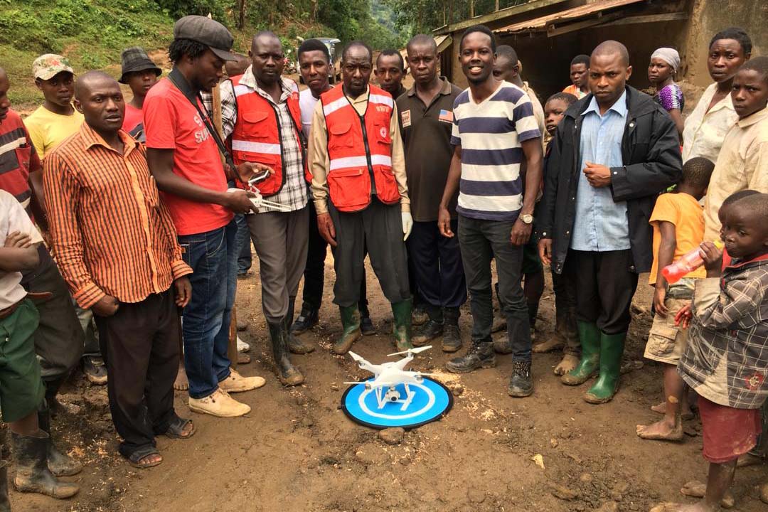
Mapping the Gorilla Highlands with Edirisa
Edirisa is a private sector enterprise seeking to facilitate tourism as a means for economic development. Besides using multimedia tools to promote the Gorilla Highlands region, Edirisa also offers lodging and canoe trekking...
What people say about OpenStreetMap Uganda
-
All our humanity force continues to prove itself with great attachment to mapping, proffesionalism, commitment and client care adding to reality to help you know where, what and how things are for a sustainable environment.
 Stella Wava - YouthMapper
 -
As a growing community in Uganda today, OpenStreetMap Uganda is having a great impact on the lives of individuals in solving some of the world's problems today.
 Geoffrey Kateregga - Board Chairman